DAY 2 (25th September 2023) – JEJU ISLAND (Southwestern Side)
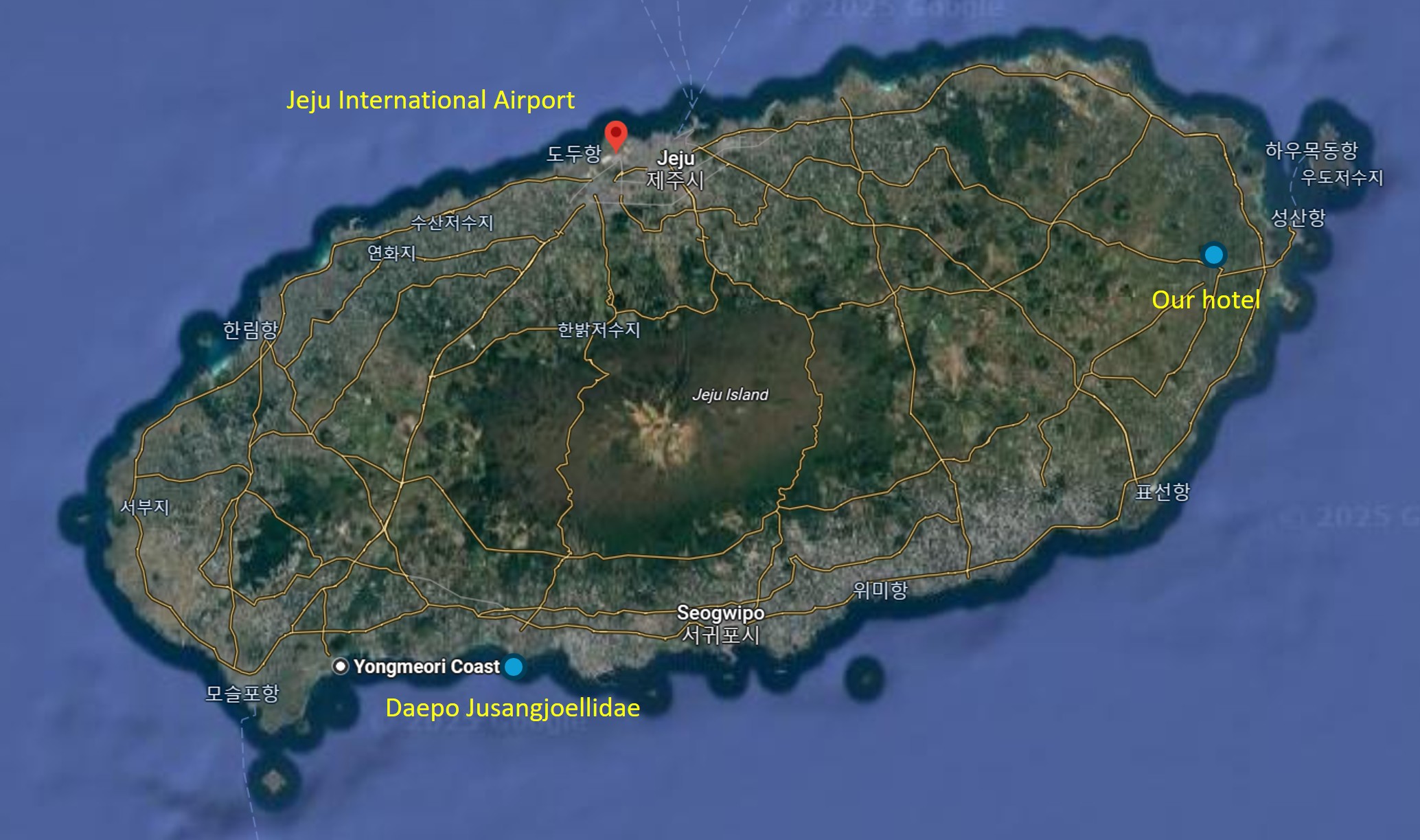
We left for Jeju Island on board a local flight, which took about an hour. With a rented car, we would be able to travel anywhere on the island of 650,000 people, which is also home to many diverse tourist destinations. For this day, we only covered the southwestern area of the island, the shape of which is a little like an elongated oval, stretched along the northeastern-southwestern axis.
After a scrumptious lunch, we would drive almost an hour to the Yongmeori Coast, where the sands of the beach were black in colour and has several geological features which were unique to the area. We inadvertently drove into a fishing village, and decided to walk around a bit before heading to the Daepo Jusangjeollidae cliffs where the remnants of ancient volcanic activities have spawn hexagonal shaped rock columns, again, a geological marvel.
Then, we drove across to the eastern side of the island to a town called Seongsan, passing by Seogwipo, the biggest town on the southern side of the island. We tried to get to the Seogwipo Jeongbang Waterfall, but arrived there a little too late and the entrance to the park was already closed.
Now We Know
It is important to take note that while we can view Google Maps in South Korea, we may not be able to use the app effectively. If you want to search for a place, for example the Gyeongbokgung Palace, you will still be able to see it on the map. However, if you intend to walk or drive there from the Myeongdong area (less than 2km), Google Maps would not be able to show you the way. It will instruct you to take the public transport, which may take much longer than if you walk!
That is because the South Korean government does not agree with some of Google Maps policies, which insist to show everything on the map, even if they are militarily sensitive. Since South Korea is technically still at war with North Korea, this poses a deep security issue. Hence, it would be better for foreigners and travellers to use the Kakaomap app. The ban on Google Maps is still effective currently.
Lunch near the Airport
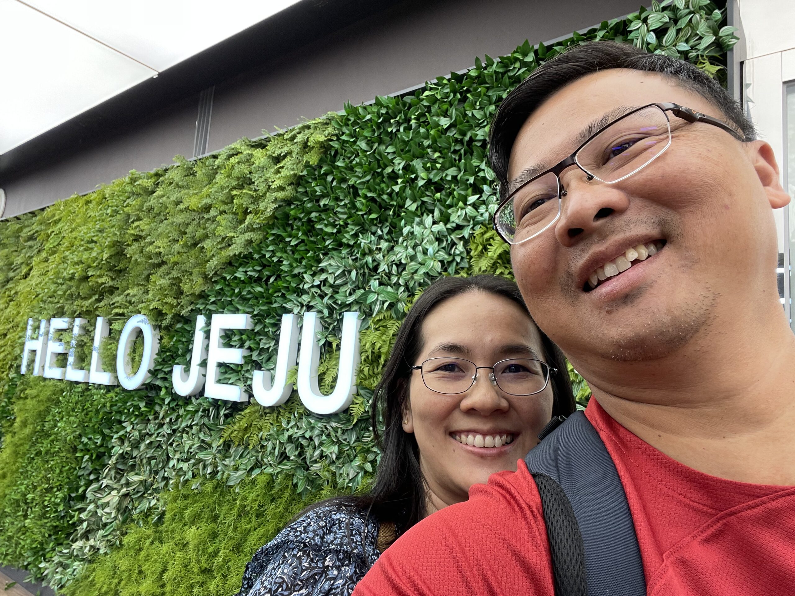
Hello Jeju: "Game start...."
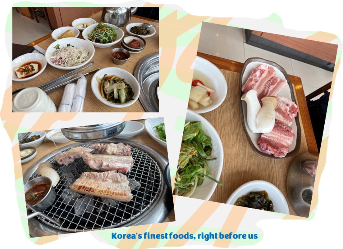
We arrived at Jeju International Airport at around 10:00 in the morning, and proceeded on to collect our rental car as the first order of business. By the time we were done with the registrations and documentations, it was almost time for lunch. We decided to treat ourselves to the wonderful tastes of Korea, and we discovered one such restaurant not too far from the airport (Bro Ray: Apologies, as I cannot remember the name of the restaurant and I can’t seem to find it on the maps either).
The food – well, everything you would expect from Korea’s rich food heritage! I have no complaints, really. Just look at the pictures.
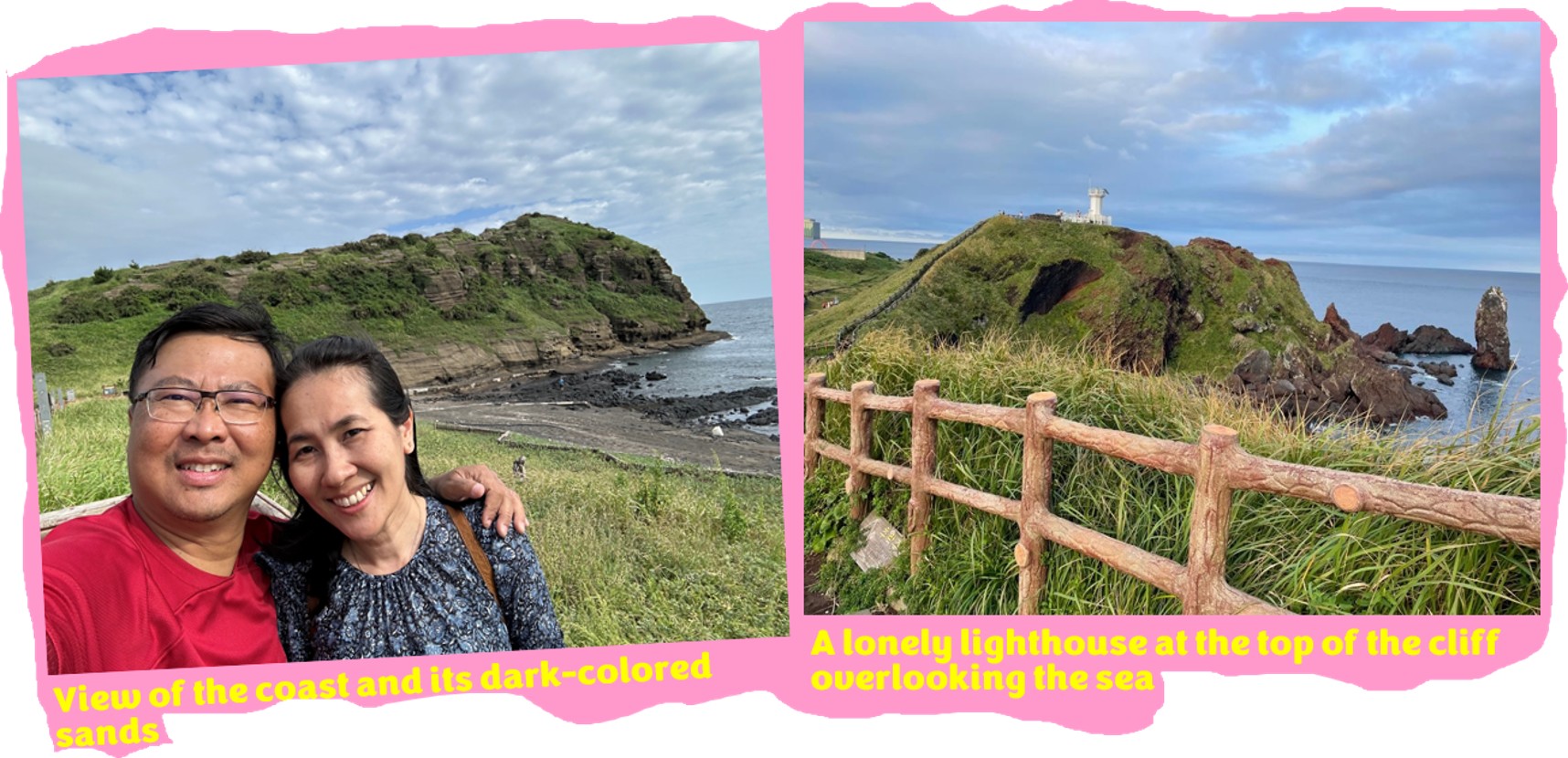
Yongmeori Coast
So after that delicious lunch, we drove southward towards the Yongmeori Coast, famous for the natural sandstone formations, formed over millions of years. It got its name from “yong” meaning dragon and “meori” meaning head, from the Korean language. From the sea, the sandstone formation gives the impression of a dragon jumping into the ocean with its head raised. For the less adventurous, we could just walk on the well-made concrete paths and view the coastline from the top, but there are paths leading to the seaside, where the sand is dark in colour.
If I had known earlier that that there were cavern-like rock formations and stratified rock walls along the coastline, I would’ve considered venturing down the cliff. My photos clearly show that we only hung around the top of the cliff following the guided paths. Dang! Now, looking at the stunning photos others have taken and posted online, my photos do no justice to this place. There are certainly many more things to explore.
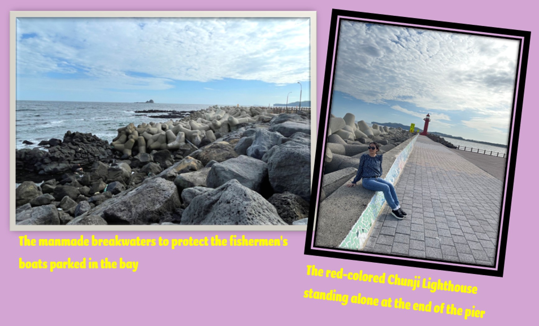
Small Village Near Yongmeori Coast
As we left the Yongmeori Coast tourist area, we ended up at a small village just nearby. It had a man-made breakwater, at the end of which, stood a lonely lighthouse, painted red. There are several red-coloured lighthouses in Jeju Island, usually paired along with white ones as colour contrast and to differentiate between the lighthouses. The most famous pair are the horse-shaped ones located at Iho Tewoo Beach. We didn’t go there, as time was limited. So instead, we have to be content with the one in this village.
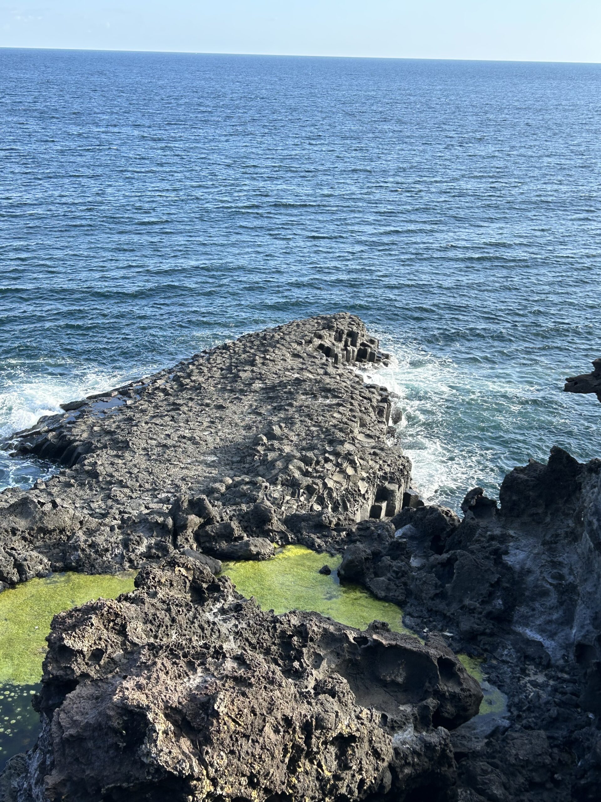
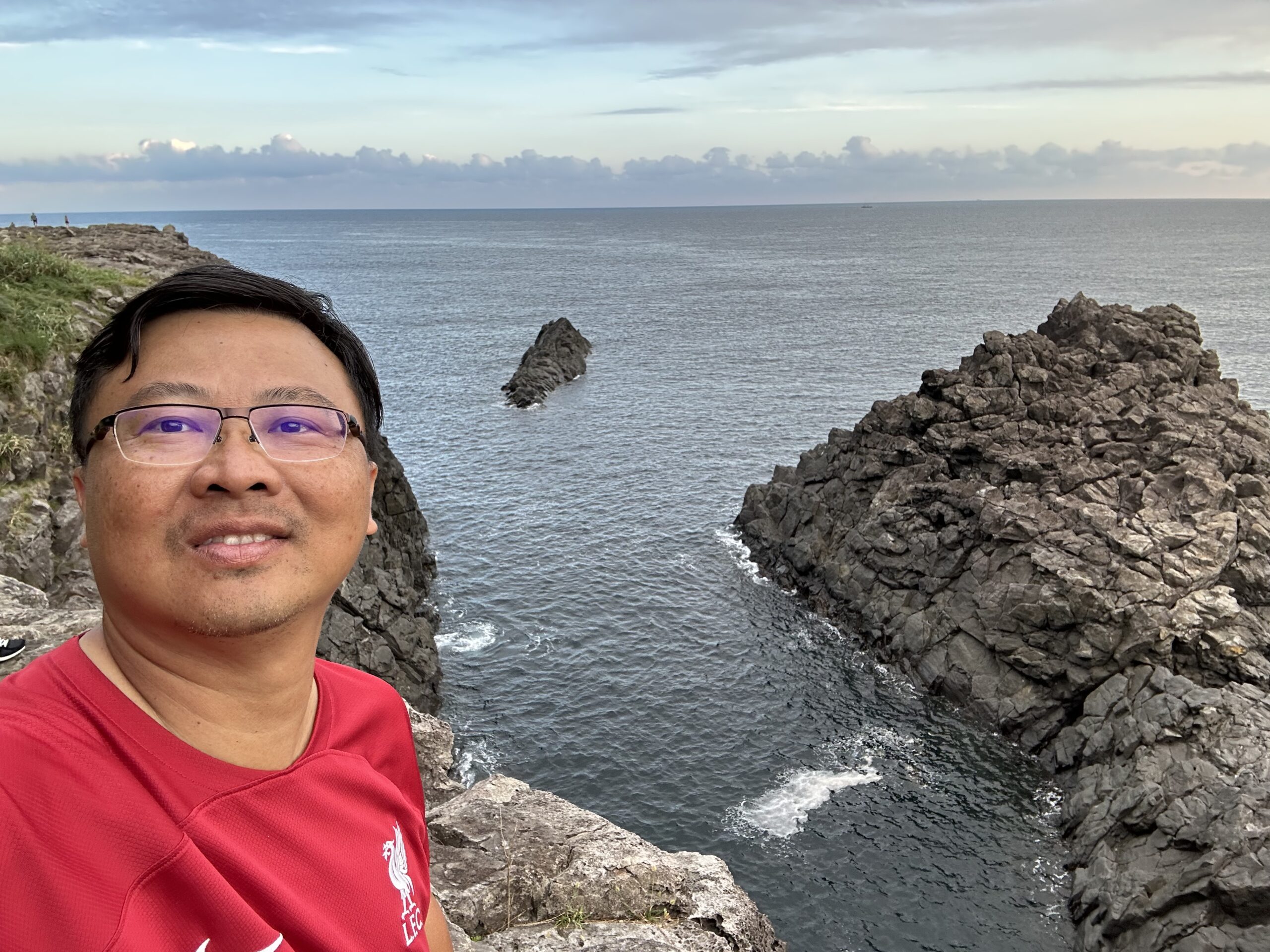
Daepo Jusangjeollidae Cliff
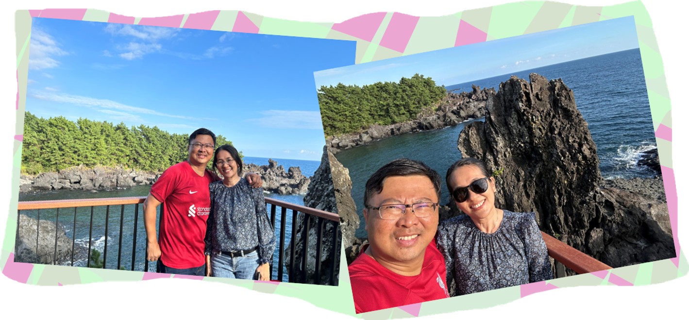
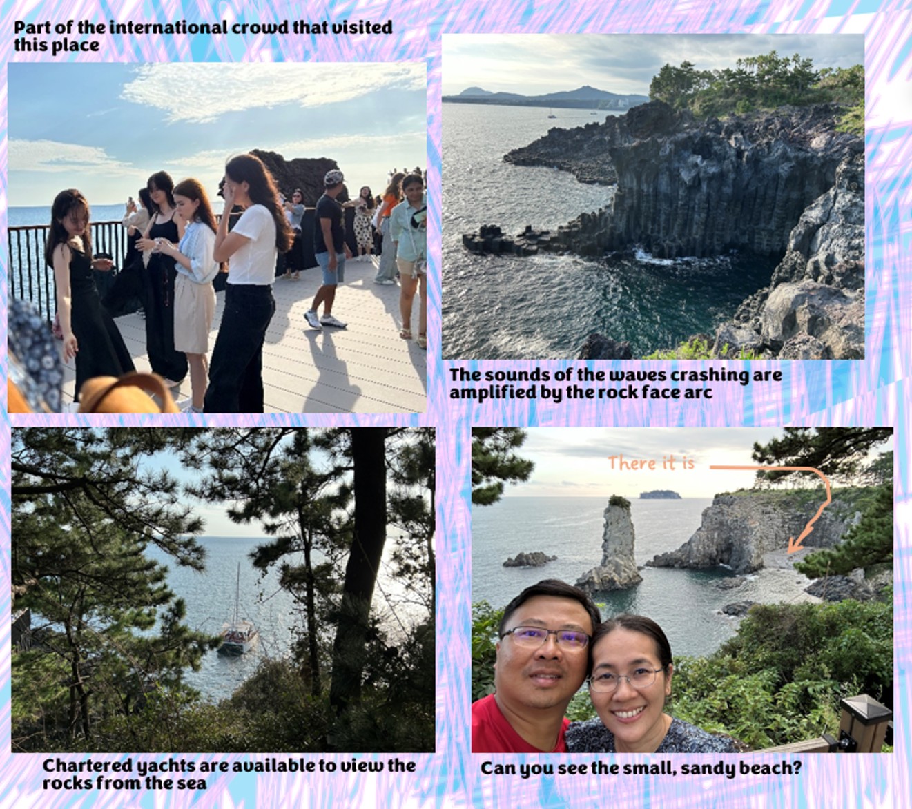
And now, to the highlight of the day – Daepo Jusangjeollidae Cliff, born out of volcanic activities between 140,000 to 250,000 years ago. This place is unique due to its hexagonal-shaped rock pillars, which was formed when lava from the Hallasan Region cooled rapidly upon contact with the sea. There are two ways to view these impressive rock formations – via the viewing platforms within the park or from the sea through the designated tour agencies. The rock formation actually stretches for over one kilometre.
The crashing of the powerful sea waves in the area also make for spectacular viewing, and at the area where the formations form an arc, the sounds of the waves are amplified by the echoes off the arc. Even though it was already quite late in the afternoon when we arrived, there was still a crowd of people trying to catch glimpses of the famous coastline.
The unique hexagonal (six-sided) shape of the rock columns make this place truly special
Different parts of the walkway give different views of the coastline
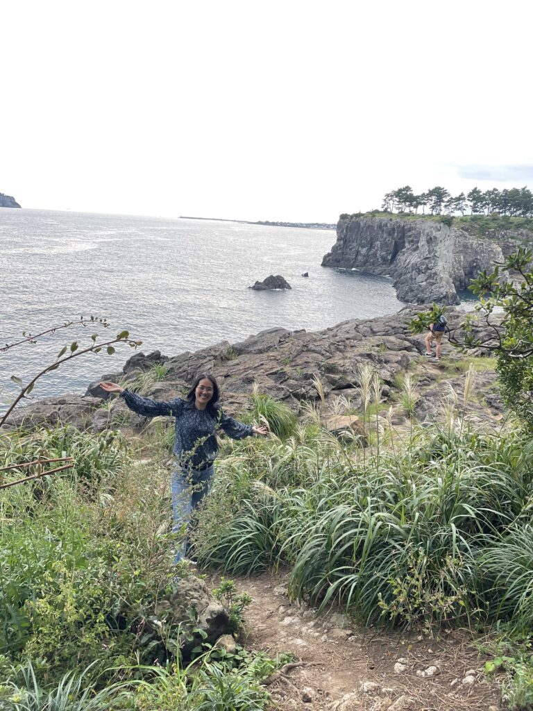
Wifey almost blending into the environment
Seriously, that looks like Godzilla making an approach
The weather was actually perfect during our time here at the park. Even though it is early autumn and the sun was dipping into the horizon, the wind did not really pick up during our time there, which made for pleasant walking. But maybe we hung around too long, as we arrived at the Seogwipo Jeongbang Waterfalls too late. It was dark and the park was already closed.
The waterfall in this park is unique because the town of Seowipo is situated on a plateau that borders the coastline. Hence, the Jeongbang River empties itself into the sea as a waterfall. It is not the only one in the area – there are several other such waterfalls along the southern side of the island, but the Jeongbang RiverWaterfall is the most famous. After that, we drove straight to the eastern side of the island, where our hotel was and called it a day.
Summary of Day 2
My immediate feeling after the day was done, was that we missed out on so much that Jeju Island actually had to offer. And even though we were at Yongmeori Coast, we actually missed the most exciting bits of it, and missing out on seeing the Seogwipo Jeongbang Waterfall was painful too. Thankfully the cliffs of Daepo Jusangjeollidae made up for it somewhat. How nature, in her own way, could form almost perfect hexagonal columns in the sea – that alone, is amazing. Of course, this is not the only place in the world which has these hexagonal columns – the other famous ones being the Giant’s Causeway in Northern Ireland and on the Isle of Staffa in Scotland.
From the northern side of the island to the southwest, and then all the way to the east
DAY 7 (30th September 2023) – SEOUL (Demilitarized Zone) Although not many people would consider this a touristy place per se, as an adventure traveller,